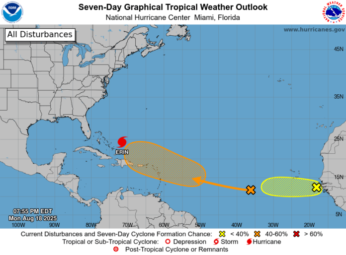
Meteorologists are keeping a close watch on two tropical waves moving across the Atlantic, one of which could develop into a tropical depression later this week.
The National Hurricane Center (NHC) said on Monday evening that a tropical wave located in the central tropical Atlantic is producing disorganized showers and thunderstorms. Conditions are expected to gradually become more favourable, giving the system a 60% chance of forming into a cyclone within the next seven days.
Forecasters say the disturbance is moving west to west-northwest at about 20 mph and could approach the Leeward Islands by Friday. However, the short-term chance of development over the next 48 hours remains low, at just 10%.
A second system, located just off the coast of Africa, is also being tracked. The NHC reports that while it is producing clusters of showers and thunderstorms, only a slight chance of development exists. The wave has a 10% chance of forming within both the next two days and over the coming week as it moves westward at about 15 mph into less favourable conditions.
The peak of the Atlantic hurricane season typically falls between late August and September, and forecasters urge residents in the Caribbean and along the U.S. East Coast to monitor updates closely.


