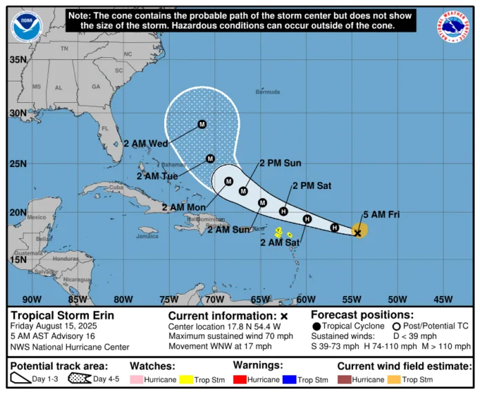
Tropical Storm Erin is expected to strengthen into a hurricane today, the US National Hurricane Center (NHC) has said.
At 05:00 local time, Erin was 570 miles (920km) east of the Northern Leeward Islands with sustained winds of 70mph (110km/h), moving west-northwest at 17mph (28km/h).
Tropical storm watches remain in place for Anguilla, Barbuda, St Martin, St Barthelemy, Saba, St Eustatius and Sint Maarten. Forecasters say Erin’s current track could take it near or just north of the northern Leeward Islands over the weekend, with winds possibly reaching major hurricane strength.
Tropical-storm-force winds extend up to 90 miles (150km) from the centre and are expected to reach the watch areas by early Saturday. Heavy rain from late Friday could bring 2-4in (5-10cm), with isolated totals of 6in (15cm), across the northernmost Leeward Islands, the US and British Virgin Islands, and parts of Puerto Rico, posing a risk of flooding and landslides.


