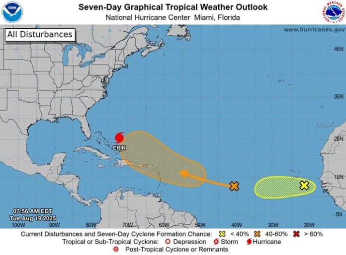
Meteorologists are keeping a close watch on two tropical systems in the Atlantic, as the region enters a period of heightened storm activity.
Near the Leeward Islands, a tropical wave is producing widespread but disorganized showers and thunderstorms. Experts say environmental conditions could allow gradual development, with a tropical depression possible by the end of the week or over the weekend. The system is moving west to west-northwest at around 20 mph and is expected to approach the Leeward Islands on Friday. Forecasters currently give it a low 10% chance of formation over the next 48 hours, rising to 60% over the next seven days.
Further east in the tropical Atlantic, another tropical wave is located a few hundred miles southeast of the Cabo Verde Islands. This system has a more concentrated area of showers and thunderstorms and is moving westward at approximately 15 mph. While conditions are generally favourable for development over the next couple of days, meteorologists warn that less favourable conditions later in the week may limit its progress. The system has a 30% chance of formation over both the next 48 hours and the next seven days.
The National Hurricane Center continues to monitor both systems closely as the Atlantic hurricane season progresses.


